This past Saturday, I hiked Hwaak Mountain, which is located east of Seoul in Gyeonggi-do (Gyeonggi Province). It rises 1468 m, and is the highest peak in Gyeonggido. I wrote an earlier post about “difficult” mountains. Hwaak mountain is one of the difficult mountains, or Ak-san (악산). There are 5 “Ak-san” in Gyeonggi Province, and Hwaak Mountain is the highest one of them.
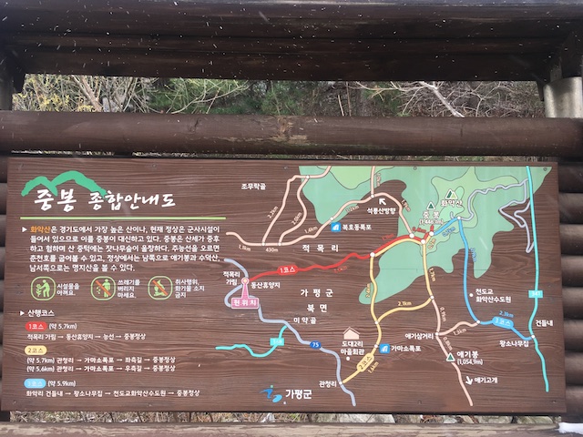
My starting point was at Jeongmok-ri, which is just west of the mountain. As you can see in the map below, there are a few courses to the top. I took the course labeled “Course 1,” which is in red. It was a 5.7 km trek to the top of the mountain, which is called Jung-bong Peak.
The first part of the course was an easy course for the most part. It had snowed the night before, and there was just a sprinkling of snow as I began the hike. There was also just a dusting of snow on the ground at the start of the course, but as I hiked up the mountain, the level of snow increased, and there was a couple of inches of snow by the time I got to the top. The course also got a bit steeper, and lived up to its name as being an “Ak-san.”
Hwaaksan is a good mountain to visit if you want to get away from the crowds that sometimes descend upon the Korean mountains on the weekends. I only saw 5 people (3 solo hikers, and a pair of 2 hikers) on my way up to the peak, and saw no one else on the way down from the peak.
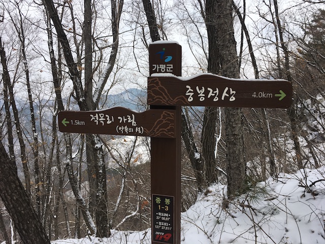
The trail up was marked with a few signs. It had snowed recently, and it seemed that another person had hiked up the mountain after the snowfall, so I was able to follow the person’s footsteps along the trail.
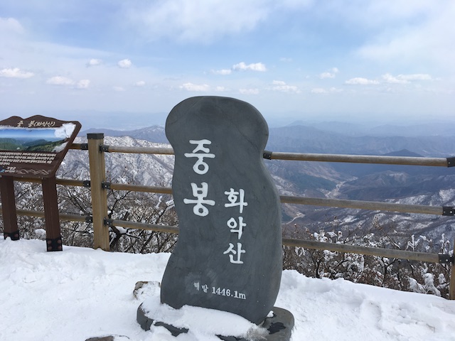
The view from the top was superb! I love the mountains in the winter, and there was a nice cover of snow blanketing the region. Luckily, the air quality was pretty good, and you could see all around in all directions.
My way down the mountain, however, was a bit of a challenge. I should mention first that the mountain is also home to a Korean military base. So, the top of the mountain also has a military installation, and parts of the mountain are closed off to the public. In fact, some areas are closed off due to the fact that there may still be active mines there. The mines were dropped by American planes during the Korean war.
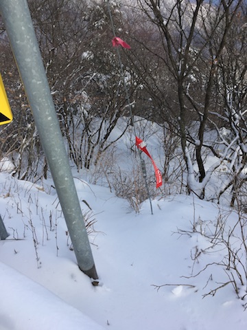
I had planned to take “Course 3” down the mountain to Wangsonamujip, and then take a local bus, but when I got there, the trail was covered by deep snow. Here’s a sign pointing to the trail down an embankment off the road.
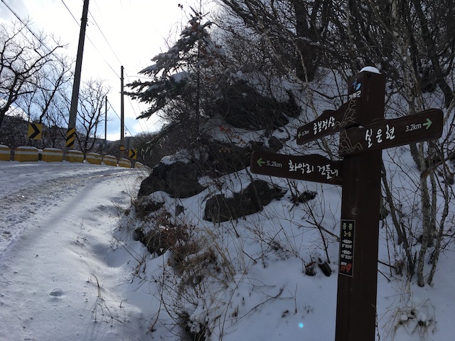
The trail itself was so deeply covered with snow that I wasn’t sure I would be able to follow it once I got on it. It seemed like no one had taken that trail down for a long time, as there were no footprints or signs of previous hikers.
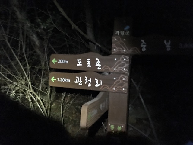
Also, unfortunately, this mountain didn’t seem to have any posted maps, except for that one map at the beginning of the trail. Most of the large Korean mountains that I have traveled to have had various maps posted along the way. The maps usually show the location of different trails and one’s “current position” is clearly marked on them.
I ended up backtracking back towards my starting point. I elected to take “Course 2,” which is the yellow route in the map above. It looked like a steeper trail, and would get me farther down the mountain. Since I wouldn’t be able to take the bus that I had planned to take, I thought I would save on the taxi fare by hiking farther down the mountain.
Course 2 down the mountain was much steeper than Course 1. I always try to leave enough time so that I am off the mountain by nightfall, and I’ve never hiked by myself in the dark below. (Although I hiked up Seorak-san in the dark, it was with a large group of people.) I had left a little later that day to Hwaaksan since the weather forecast said that the air quality wouldn’t be that great early in the morning, but would clear up later in the day.
Luckily, I brought my headlamp (and an extra flashlight) with me, which I always bring just in case, when I go on long hikes. Towards the end of my hike, it got dark, and I hadn’t realized that Course 2 led one through Ka-ma Waterfall (가마폭포). I had to cross various streams in the dark, and the final pass through the waterfall area was a bit difficult to say the least.
My lesson learned for this trip was to always plan a second route in case the first route down doesn’t work out. If I had known about potentially hiking through the waterfall area during nightfall, I probably would have gone back the way I came instead of trying to take what I thought would be a shortcut. And, for any potential hikers out there, I wouldn’t count on having posted maps on the mountain itself.
Overall, this was a great trip though. The views at the top of the mountain were excellent, and I enjoyed the snowy hike. The hike down challenged me a bit to keep calm, and the hike overall taught me more about what I should do to become a good hiker.